Project
Urban Flood Risk & Runoff Impact Assessment
Quantify how urbanisation and extreme rainfall increase flood risk and drainage stress.
Objective
Understand how rapid urbanisation and extreme rainfall increase flood risk in fast-growing Indian cities.
What we did
We combined satellite-derived land-use change, impervious surface growth, rainfall statistics, and GIS-coupled hydrological models (e.g. SWMM, HEC-HMS). Sentinel-1 radar imagery was used to capture flood extent during extreme rainfall events, including under heavy cloud cover.
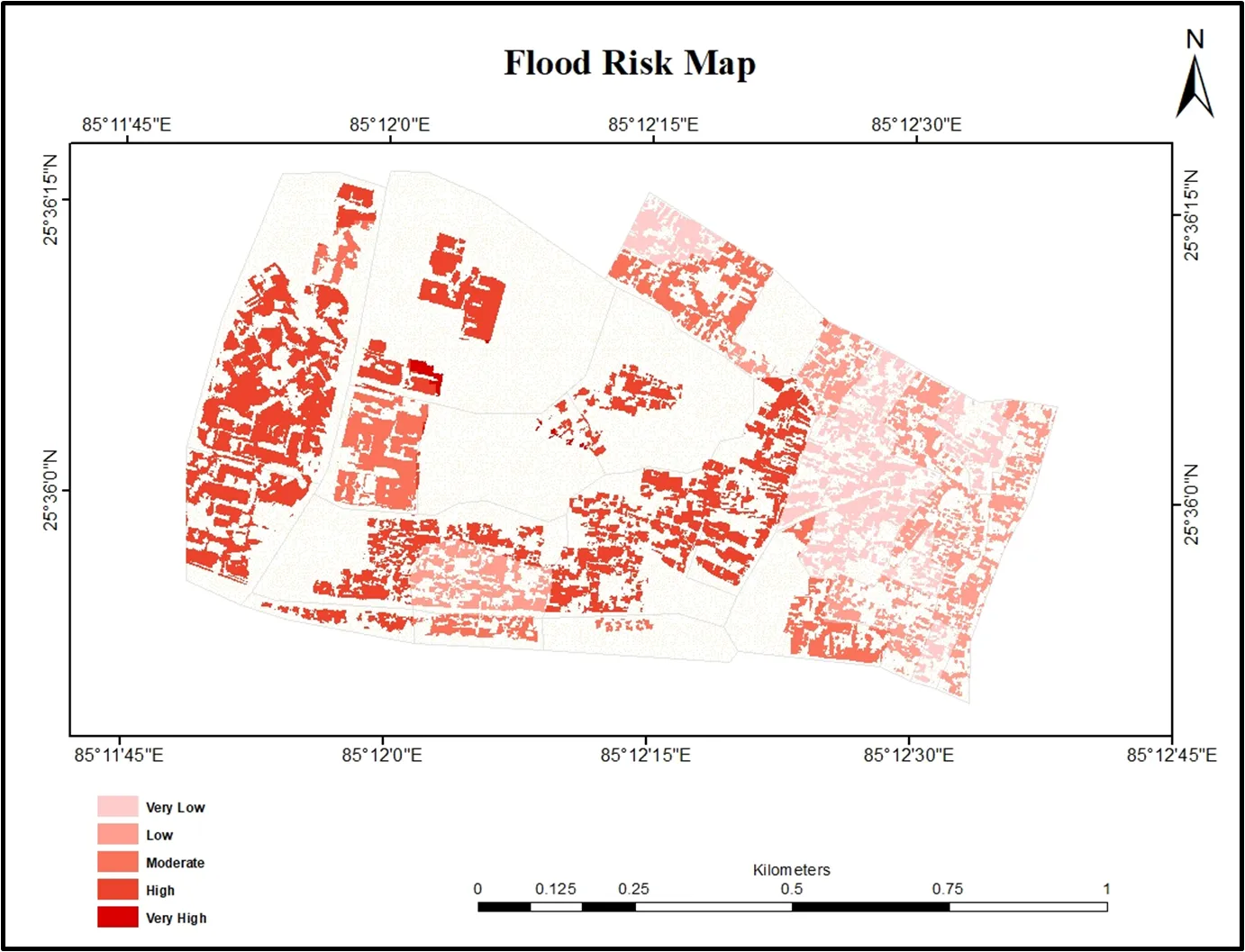
Outcome
- Flood hazard and flood risk maps
- Identification of high-risk wards
- Quantified impact of urban growth on runoff and drainage stress
- Evidence to support drainage upgrades and land-use controls