The answers are already orbiting overhead We bring them down to earth.
Anora Intel analyses geospatial data, providing decision makers with evidence-based responses to urban growth, pollution and climate risk.
See Ask EarthSupporting India's national programmes
Anora Intel's services are designed to help state governments and urban local bodies access, comply with, and report against India's central schemes.


Defined services
Natural hazard and risk assessment
Multi-hazard risk atlases, flood inundation modelling, landslide susceptibility mapping, and drought monitoring — the spatial foundation for safe urban growth and infrastructure investment.
- Flood, landslide, cloudburst and drought risk modelling
- Susceptibility, vulnerability and hazard layers combined
- Risk-informed planning aligned with NDMA guidelines
Urban analytics
From growth scenario modelling and heat island assessment to solar suitability and infrastructure mapping — spatial intelligence for the decisions that shape India's cities.
- Growth scenario modelling to 2030/2040
- Heat island assessment and intervention modelling
- Solar suitability, green space and infrastructure mapping
Recent analyses
Building-Level Energy Demand
Estimate relative building energy demand without relying on utility data.
Urban Flood Risk & Runoff
Quantify how urbanisation and extreme rainfall increase flood risk and drainage stress.
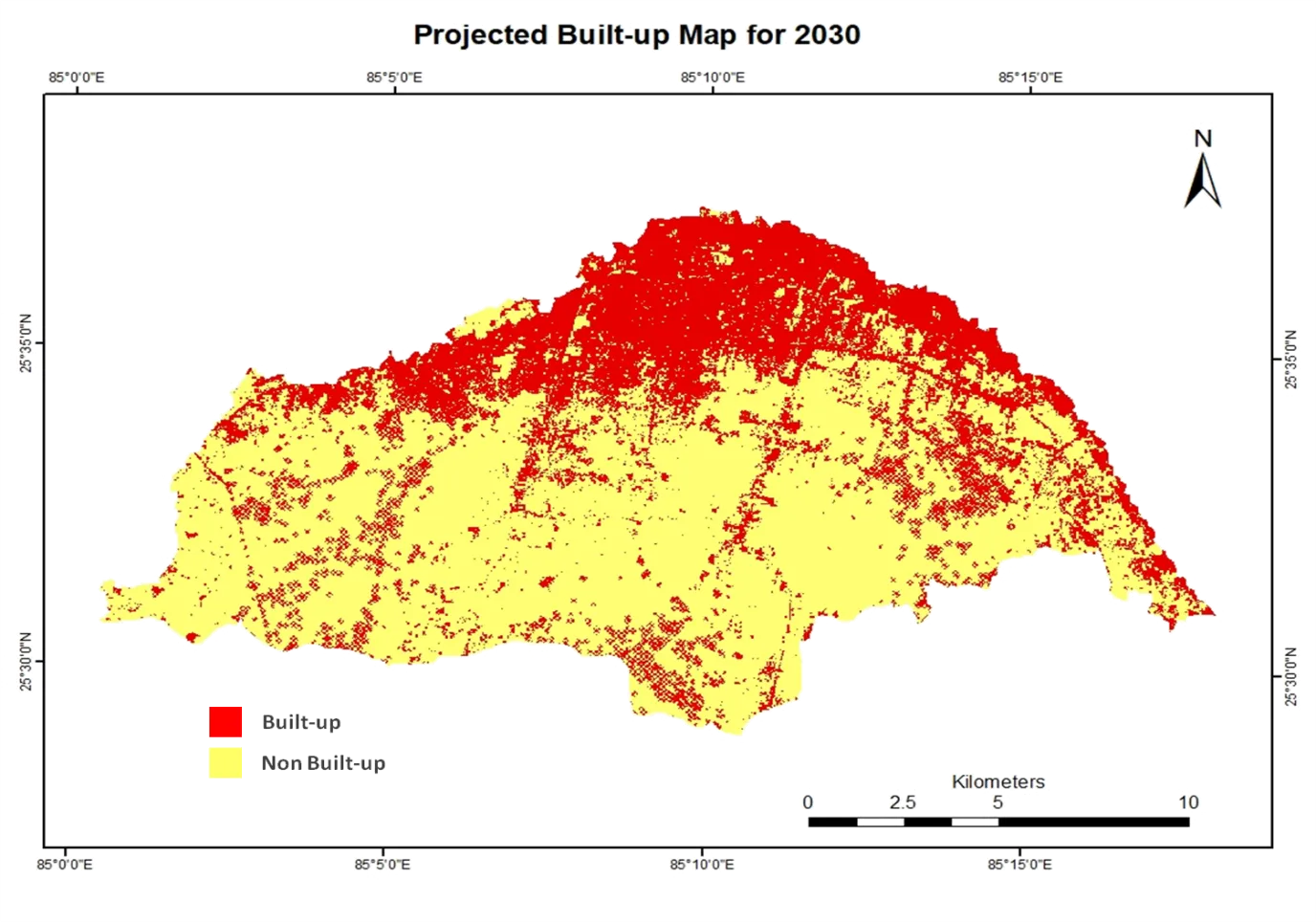
Urban Growth Scenario Modelling
Project urban expansion for 2030/2040 and link scenarios to flood and heat risk.