Project
Long-Term Urban Growth & Scenario Modelling
Project urban expansion for 2030/2040 and link scenarios to flood and heat risk.
Objective
Anticipate future urban expansion and its environmental consequences.
What we did
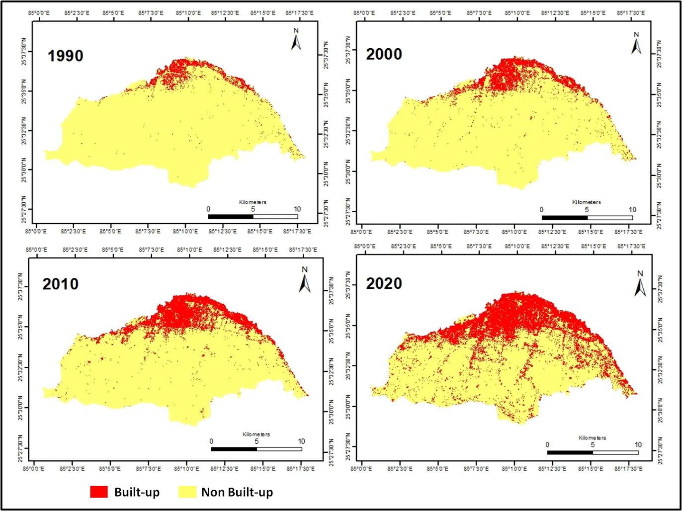
Using time-series satellite imagery, we analysed three decades of built-up growth and applied CA–Markov modelling to project urban expansion scenarios for 2030 and 2040. These projections were then linked to flood and heat risk indicators.
Outcome
- Observed and projected urban growth maps
- Quantified future pressure on drainage and climate resilience
- Strategic input for master planning and infrastructure phasing