
What we offer
Independent site monitoring
Third-party satellite measurement of a site and the ground around it. Footprint, restoration, water and ground level, tracked against a fixed baseline without operator involvement.
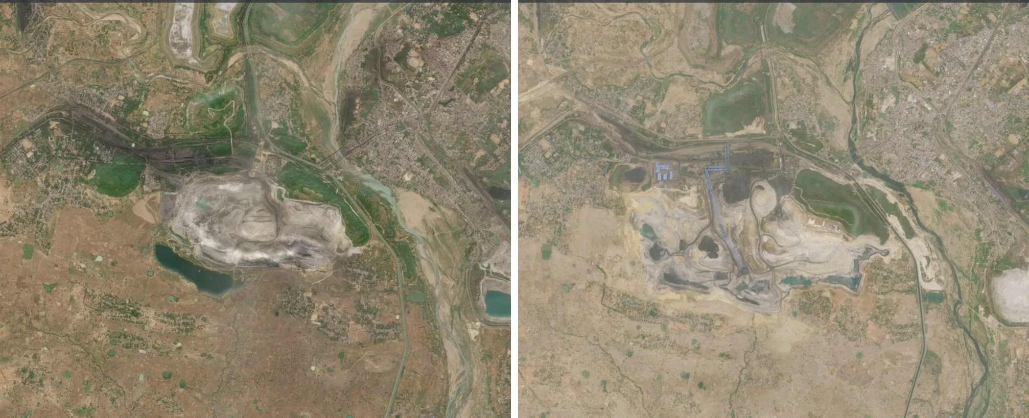
“What does the site and its surroundings actually look like?”
Baseline mapping
Footprint, land use, vegetation, water bodies and surface level at the site and around it. Dated and mapped.
“Is the commitment being met, year on year?”
Repeat-cycle monitoring
The same measures tracked against that baseline: area, re-vegetated ground, water extent and turbidity, subsidence and settlement.
“Can this go into a disclosure or in front of an assurer?”
Independent verification
Produced without operator involvement and tied directly to the site's clearance conditions and the disclosures they feed.
What the site looked like, what has changed since, and a record of it that was not produced by the operator.
Service overview
A site carries obligations that need evidence somebody other than the operator produced: clearance conditions, restoration and green-belt commitments, effluent limits, and for larger listed companies SEBI’s BRSR Core, which makes that assurance mandatory rather than optional.
Anora Intel measures the site and the ground around it from orbit. Every output is dated, mapped, and produced without operator involvement.
Service modules
Footprint and land-use change
The site boundary traced year on year from spectral indices, with area reported per year on a fixed area of interest. Boundaries from free data are accurate to about ten metres. Thresholds are tuned once and frozen across every year, so the trend is real even where the absolute number carries uncertainty.
Restoration and re-vegetation
Area re-vegetated each year on reclaimed land and spoil, checked against the approved plan. Vegetation condition tracked with the same index across dates, so a change is a change and not a difference in method.
Water bodies and effluent
Extent and change of pit water, ponds and nearby water bodies, with indicative turbidity signals on receiving water.
Ground stability
Two radar images of the same ground weeks apart show millimetres of movement no camera would catch. A concentrated subsidence bowl usually points to active workings or spoil that has not finished settling, and it is a safety question before it is a compliance one.
Boundary compliance
Once a footprint is traced, checking it against a sanctioned boundary is a geometry comparison, run automatically each year rather than by eye. Anything outside the line is flagged with its own area figure.
Applications
Clearance and restoration reporting
Evidence against the conditions attached to an approval, in a form an assurance provider can work from.
Disclosure and assurance
Land-use, water and restoration measures structured for BRSR Core and comparable disclosure frameworks.
Boundary and encroachment checks
Annual, automatic comparison of measured footprint against a sanctioned boundary.
Closure planning
Subsidence and settlement patterns relevant to closure sign-off and to worker and infrastructure safety.